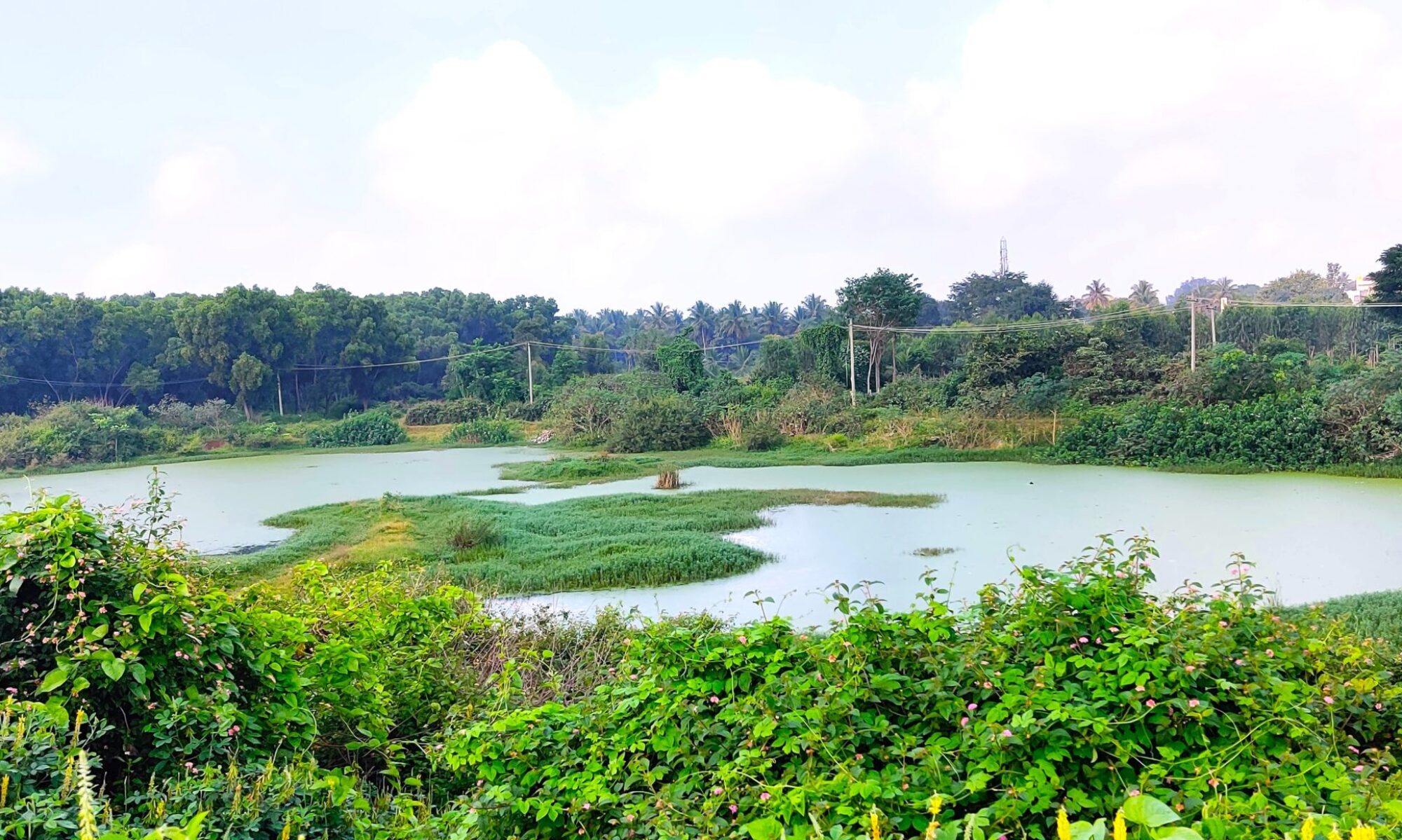
Tanks of Anekal
This website documents the larger water bodies of Anekal taluk. As Anekal Taluk urbanizes rapidly, the tanks and associated kaluves are lost due to neglect, encroachment or land diversion. We hope that this website provides a comprehensive picture of the condition of the larger tanks in Anekal and proves useful to different groups of people: lake activists working towards the conservation of their water body, government officials at the district and gram panchayat level, college and school students and natural history enthusiasts.
With this website we have aggregated spatial information from different government websites along with information on natural resources (flora and fauna). It provides a comprehensive, easy-to-understand overview of urban lakes, ensuring that valuable information is both accessible and actionable – Explore our interactive Urban Lake Dashboard here.
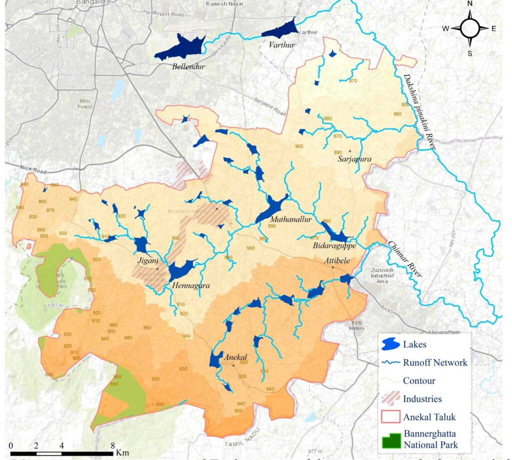
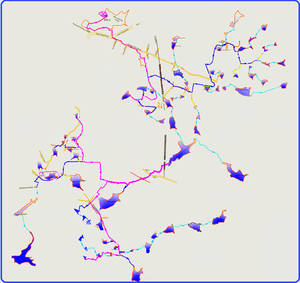
The cascading tank systems
The plains of South India have been engineered over the last 1000 years into an agricultural landscape through an intricate network of tanks. The geography of the area with its low hills and gentle slopes has favored tanks as a way to hold large quantities of water allowing irrigation of large tracts of land. Evidence from Anekal taluk points to the existence of tanks from the Chola era.

Whither Anekal: Interpreting the future of Anekal taluk based on government planning documents
The fate of Anekal’s tanks (and more generally of all its natural resources) lies in its master plan. Two big developments that are slated to happen in the next decade within Anekal are the Satellite Town Ring Road (STRR) that will pass through a large portion of the taluk and the Koramangala-Challaghatta (KC) Valley project. The STRR is a 280 km ring road that will encircle the Greater Bengaluru area.
The Koramanagala-Challaghatta (KC) valley tank-filling lift-irrigation project delivers secondary treated water from Bengaluru’s sewage system to tanks in the Kolar and Chickballapur region. Because of the success of this project as an extension it is now planned that 120 MLD (million litres per day) of treated water will be discharged into over 65 tanks in Anekal.
A masterplan is a planning document that a city or state government uses to determine how to develop a particular area to meet its constituents’ needs. The master plans of Indian cities have been criticized for having an overly spatial outlook in terms of deciding how a city or area should develop. This is as opposed to a planning document that starts by asking its citizens (especially the most vulnerable ones) what they would like so that it can lead to fulfilling lives.
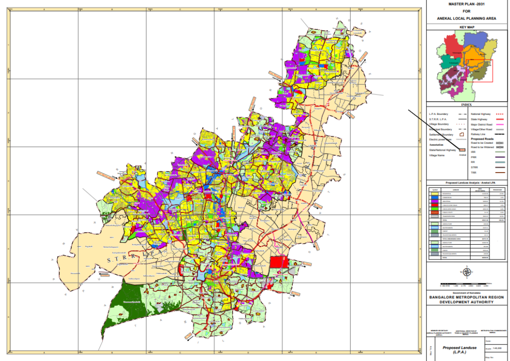
Anekal’s master plan 2031 suffers from similar short-comings. The master plan only demarcates different areas based on their current use category. We see based on the colour coding in the map below that purple which refers to industrial use is 21.3 % of total land and yellow which is residential is 47%. However we also see that a large proportion of the taluk is marked beige which means no land use has been proposed for this region in the 2031 master plan. Click here to download Anekal’s 2031 Master plan
A little further digging shows that the STRR Land Planning Authority (STRR LPA) is supposed to be in charge of deciding what happens in this area. But a look at the STRR website doesn’t reveal any plans for the coming decades on what is supposed to happen.
Both these projects will have a tremendous impact on Anekal’s water landscape. These are a few shifts that will happen to Anekal’s land use and there is an urgent need to monitor them and plan for the future.